Syntool - All the recent updates
It's not Christmas, but close enough!
by Sylvain Herlédan
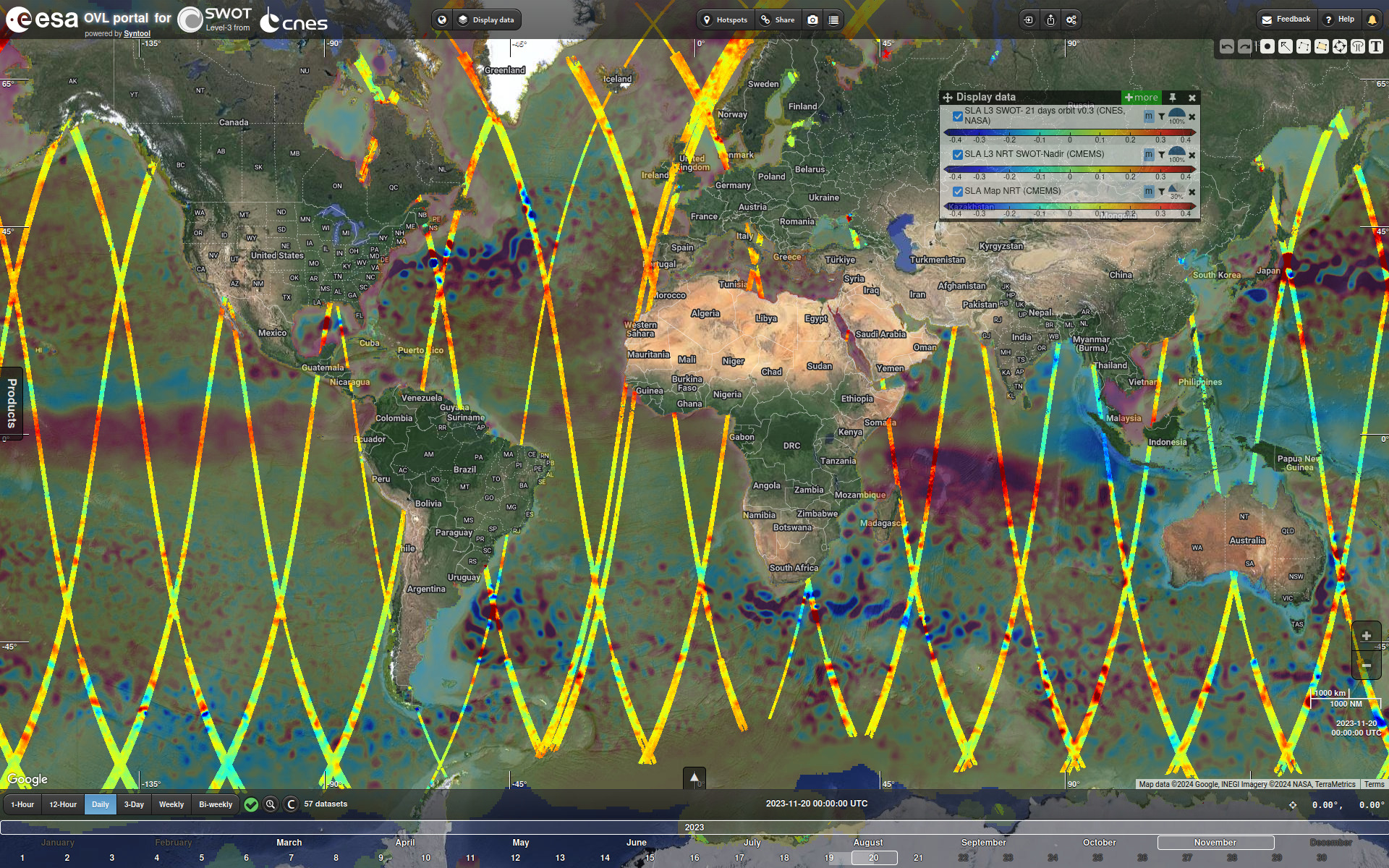
The long awaited SWOT calval portal
Rejoice! We have finally been allowed to make our Syntool portal for SWOT L3 data available publicly, so that everyone can have a look at SWOT Sea Surface Height (SSH), Sea Level Anomaly (SLA) and geostrophic current and visualize them along with the other products we have in Syntool (notably the OVL instance) to compare, assess and find synergies with all these data.This new portal is available at https://swot-calval.oceandatalab.com

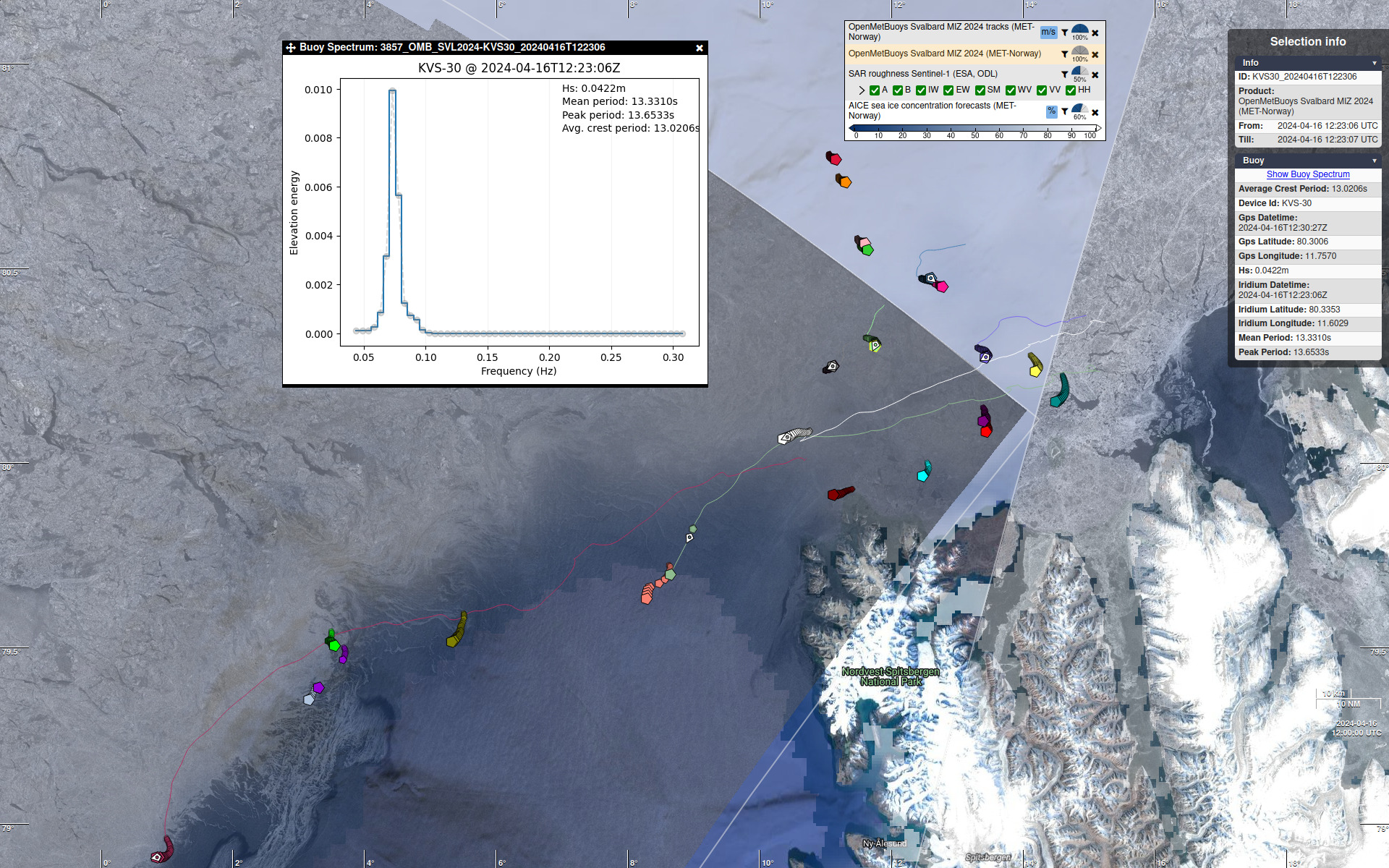
MIZ Svalbard 2024 experiment with OpenMetBuoy devices
After the Agulhas current, the marginal ice zone close to Svalbard! These buoys are everywhere! :)A new experiment lead by the Norwegian Meteorological Institute (MET-Norway) is currently taking place to acquire more measurements of wave, temperature and sea-ice drift in the MIZ North-West of Svalbard: https://focus-arctic.com/svalmiz2024.html
The OpenMetBuoy devices deployed during the SvalMIZ 2024 experiment are an extended version of the open-source drifters (see source code and paper) able to measure wave, drifter-position, and temperature. Using an Iridium connection, they transmit hourly significant wave height, 30-minute temperature (1m height, surface layer (+10cm/0cm), snow-ice interface), and sea-ice drift (hourly GPS) in real-time.
These measurements appear in the OVL Syntool portal in near real time, based on the data stream kindly shared by MET-Norway, making it easier to locate the ice with satellite acquisitions while releasing and tracking devices during the deployment phase, and later on to identify interesting cases.
The new AICE product, a 10 days sea ice concentration forecast developed by MET-Norway and updated every day, has been included in the OVL Syntool portal for the occasion.
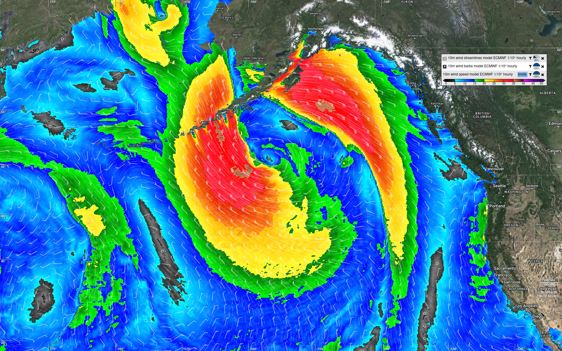
ECMWF forecast
Last month we unfortunately lost access to our source of ECMWF 3-hourly 1/8° wind forecast data.The Syntool products associated with this data source have been renamed so that the spatial and temporal resolutions appear in the label:
- "10m wind barbs model ECMWF" => "10m wind barbs model ECMWF 1/8° 3-hourly"
- "10m wind streamlines model ECMWF" => "10m wind streamlines model ECMWF 1/8° 3-hourly"
- "10m wind speed model ECMWF" => "10m wind speed model ECMWF 1/8° 3-hourly"
IFREMER gave us access to another product with a better spatial and temporal resolution, with data from 21st August 2019 up to 2 days in the future.
It is worth noting that 3-hourly products are still useful for dates prior to 21st August 2019, as they go back to 2013.
Aside from the improved resolutions, there are two major differences with the old 3-hourly products:
- The processing mechanism used for ingesting the 3-hourly data did not support overwriting results, so we waited a few days before processing the input files to make sure only the more accurate analysis was published, which basically removed the forecasting aspect. The new products are processed with a different mechanism that can overwrite results, allowing us to publish forecasts shortly after they become available and replace results when newer forecasts are available.
- For the 3-hourly 1/8° products we only produced images for a small selection of zoom levels: the hourly 1/10° files are ingested in Syntool as a single image at full resolution that is scaled on-the-fly to be displayed at all zoom levels
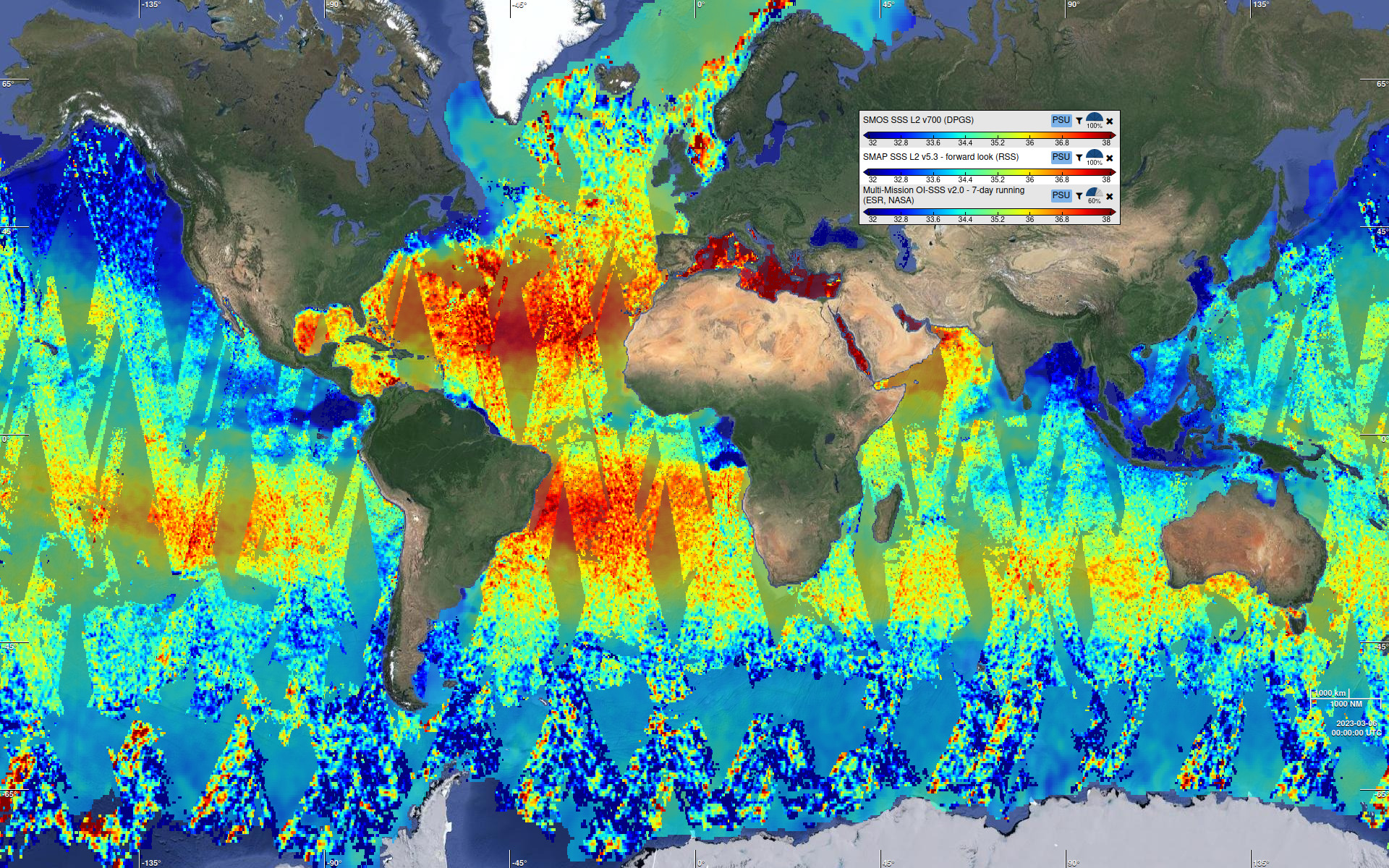
Updates in the PiMEP Syntool portal
Most of the salinity and auxiliary products available in the PiMEP Syntool portal have been updated, sometimes with a simple temporal extension:- SMOS SSS L2 v700 (DPGS)
- SMOS SSS L3 v335/343 - 10 days (CATDS-CPDC)
- SMOS SSS L3 v335/343 - Monthly (CATDS-CPDC)
- SMAP SSS L2 v5.0 (JPL)
- SMAP SSS L3 v5.0 - 8 Days running (JPL)
- HYCOM model SSS [L3 v5.0 JPL] (NOPP)
- SST OSTIA (CMEMS)
- SST MicrowaveOI v5.1 (REMSS)
- Daily ASCAT surface wind field (IFREMER)
- Map of Sea Level Anomaly (CMEMS)
- Roemmich-Gilson salinity (Scripps)
- Gouretski and Reseghetti 2010" temperature EN 4.2.2 (UKMET)
- Gouretski and Reseghetti 2010" salinity EN 4.2.2 (UKMET)
- Levitus et al 2009" temperature EN 4.2.2 (UKMET)
- Levitus et al 2009" salinity EN 4.2.2 (UKMET)
- Geostrophic surface current DT streamlines (CMEMS)
- Geostrophic surface current NRT streamlines (CMEMS)
- CMORPH precipitation (NOAA CPC)
- SMOS SSS L3 v9 - 9 Days (CATDS-CECOS-LOCEAN)
- SMAP SSS L2 v5.3 - forward look (RSS)
- SMAP SSS L2 v5.3 - backward look (RSS)
- SMAP SSS L3 v5.3 - 8 Days running (RSS)
- HYCOM model SSS [L3 v5.3 RSS] (NOPP)
- CCI SSS L4 Merged-OI v4.41 - 8-day running (ESA)
- ISAS v8 monthly salinity at 5m (CMEMS)
- ISAS v8 monthly temperature at 5m (CMEMS)
- SMOS SSS L3 v3 - Monthly (ICDC)
- SMOS SSS L3 v2 - Daily (CATDS-CECOS-IFREMER)
- SMOS SSS L4 v2 - Weekly (CATDS-CECOS-IFREMER)
- Multi-Mission OI-SSS v2.0 - 7-day running (ESR, NASA)
We also expect an update of the in-situ products in the upcoming weeks.
Please also check out the https://www.salinity-pimep.org/ website if you are interested in case studies and matchup data between all kinds of salinity measurements!
New CMEMS imagery service
As part of the migration to the new CMEMS Data Store, the old imagery service that we used to display rasters of temperature, salinity and sea water velocity from the Global Ocean Physics Analysis and Forecast product has been decommissioned.We adapted our processing chains and Syntool portals to use the new imagery service, but it lacks a layer for the sea water velocity so we could only restore the temperature and salinity layers.
As a consequence, we removed the following products from the OVL Syntool portal:
- Surface current model Mercator 1/12° (CMEMS)
- 30m velocity model Mercator 1/12° (CMEMS)
- 100m velocity model Mercator 1/12° (CMEMS)
- 300m velocity model Mercator 1/12° (CMEMS)
- 1000m velocity model Mercator 1/12° (CMEMS)
- 3000m velocity model Mercator 1/12° (CMEMS)
- Surface current Mercator 1/12° (CMEMS)
- Sea water velocity Mercator 1/12° [100m] (CMEMS)
- Sea water velocity Mercator 1/12° [1000m] (CMEMS)
Please note that the sea surface current product represented as streamlines is hosted on our own servers and is therefore still available in Syntool portals: https://odl.bzh/25CgHJIk
Links to the OVL Syntool portal, always showing what's going on now
Ever wanted to have a link to the OVL Syntool portal that automatically selects the current datetime?
There is a small trick that will help you do that:
- Open the OVL Syntool portal
- Select the products you are interested in from the list in the catalogue panel on the left side of the screen
- Pan and zoom the map to your area of interest
- Copy the URL from the address bar of your web browser and paste it in a text file
- In the pasted URL, look for a portion which matches the following pattern: date=YYYY-mm-ddTHH:MM:SS (for example date=2024-04-16T12:00:00) and replace it by date=NOW
That's it! When you open the modified URL, the OVL Syntool portal will show the same area of the map, with the same products selection but the timeline will be centered on the current datetime. Handy to have in your bookmarks :)
Here is an example with a selection of multiple forecast products.
Well, that's it for today! Let us know what you think about these new data and features, and don't hesitate to contact us if you have any question!
You can reach us by email syntoolnobotplease oceandatalab.com, on X/Twitter @oceandatalab or on the Syntool forum
If you are currently at EGU2024 in Vienna and want to know more about our tools (Syntool and SEAScope), there will be a hands-on training course on Friday April 19th 10:45 in room 2.61. Remember to bring your computer :)


