2nd Ocean Remote Sensing Synergy Summer School in Brest (July 6 to July 10, 2015)
by dr.fab
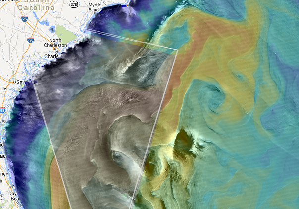
Exploring synergies amongst Ocean Remote Sensing datasets (here Ocean Surface roughness and Sea Surface Temperature)
how to :
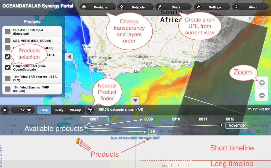
to select a particular product you can click on it on the map or in the timeline and you can play on its transparency with the keyword ( Shift + P and M keys)
- MERIS/MODIS MSS on gulf stream
- select MSS MERIS products only (unselect MSS MODIS and SST MODIS)
- zoom to find an oil spill at location around Lon -79.1 / Lat 31.0
- add MSS MODIS products and play with transparency to see the oil spill on MERIS and MODIS.
- Press Shift+T then click on « transect »
- Draw a line between two consecutive obervations of the same oil spill holding the Ctrl key to measure the distance.
- Find the sensing time difference between measurements in the short timeline.
- Estimate the surface current velocity in the Gulf Stream
- Alternatively you can click on the « extract » button, draw a bounding box while holding the Ctrl key and then click on the star over the zoom control to download all layers within the bounding box and analyse them in
- external image processing software.
- MODIS Terra and Aqua MSS on gulf stream
- click on the map to select the first layer
- play with P and M keys to switch from MODIS Terra to MODIS Aqua
- identify small eddy near Lon -78.6 Lat 31.3 (it is colder so you can look MODIS SST to help identify it
- Press Shift+T then click on « Numpy »
- Draw a line between two consecutive obervations of the same oil spill holding the Shift key to drow a extraction box. Then click on the wheel on the right to get the link to numpy file.
- estimate distance between eddy position on Terra and Aqua using ipython notebook corr.ipynb
- estimate eddy transport velocity using sensing time difference from the timeline
- SAR roughness and MODIS SST
- locate front visible both in SAR roughness and STT gradients by playing with transparency
- estimate distance between front on SAR and SST
- Estimate surface current using the sensing time difference from the timeline.