Sept 11-15, 2017 @ Porto : ESA Advanced Ocean Remote Sensing Training Course
by dr.fab
A team from OceanDataLab including Dr.fab, Lucile Gaultier and our technical support Sylvain Herlédan, will provide hands on training on Ocean current and Ocean waves. In particular, they will demonstrate some processing techniques to estimate geophysical parameters such as ocean current, sea surface roughness, cross spectra, and then the synergies amongst all Ocean Remote Sensing datasets (here Ocean Surface roughness and Sea Surface Temperature)
Geophysical parameters estimation
The training was based on the following self described ipython notebooks and making use of some open source SAR processing and data reader libraries :notebook 1 : Nice display for Sentinel-1 data (incidence angle compensation) - requires input data
notebook 2 : Swell detection on Sentinel-2 data (estimation of phase velocity between two bands)
notebook 3 : Wave propagation simulation in presence of surface current
notebook 4 : Computing geostrophic current from CMEMS SSH - requires seascope_export.py and constant.py
notebook 5 : Computing Ekman current from ECMWF wind speed - requires seascope_export.py and constant.py
notebook 6 : Computing total current from previous results - requires seascope_export.py
notebook 7 : Lagrangian advection of a particle using current velocity - requires seascope_export.py, constant.py and tools_advection.py
notebook 8 : Eulerian comparison of two current velocities
SEAScope: viewer and Python bindings
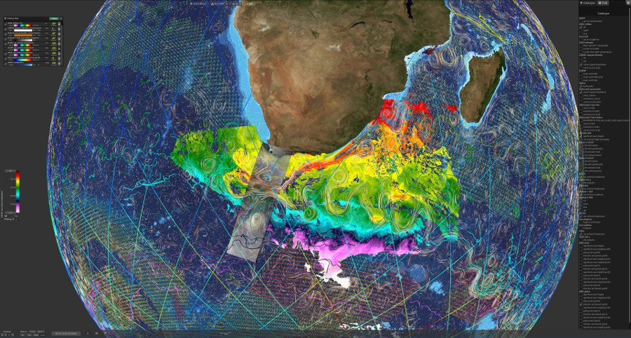
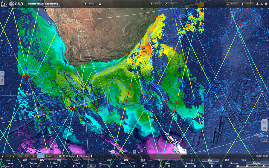
Exploring the ocean mesoscale and sub-mesoscale using thermal and optical imagery
- Good Synergy between SAR roughness, tracers and currents derived from altimetry:
- Example 1: Sea Surface Temperature (SST), Chlorophyll-a (Chl) from MODIS and VIIRS are well correlated with GlobCurrent current (Along track Jason-2 above mesoscale eddies)
- Example 2: SAR from Sentinel-1, SST and Chl from VIIRS are in good agreement with altimetry
- No front can be detected in one of the tracer:
- Example 1: No temperature gradient in the SST but signature of the eddy can be seen on the Chl from MODIS
- Example 2: Wind is blowing, no features are visible in the SST but Chl from MODIS is in good agreement with GlobCurrent current.
- Synergy using Sentinels:
- Example 1: SAR from Sentinel-1, true RGB from OLCI Sentinel-3 and altimetry from SRAL Sentinel-3 are all clearly showing a mesoscale eddy
- Bad correlation between tracer and currents derived from altimetry:
- Example 1: SST and Chl from MODIS and VIIRS and GlobCurrent currents are showing some discrepancies: It highlights the lack of temporal resolution in currents derived from altimetry as there is no altimeter track above the missed turn.
- Example 2: In-situ LASER drifters are in good agreement with SST fronts and reveal errors in GlobCurrent currents
Understanding the polar oceans from space
Marginal Ice ZoneSentinel-1 and ASCAT